- Dec 2
- Children of the Arctic
- Apr 18
- Snow, Wind, and Ice
- Apr 16
- Lesson from the Arctic
- Apr 14
- I Love Doing Science!
- Jan 28
- Bouncing Back in Whiteness
- Jan 27
- The Magical SAR Queen Rules!
- Jan 26
- Arctic Winter Science
- Jan 25
- A Day to Chill
4/13/2017
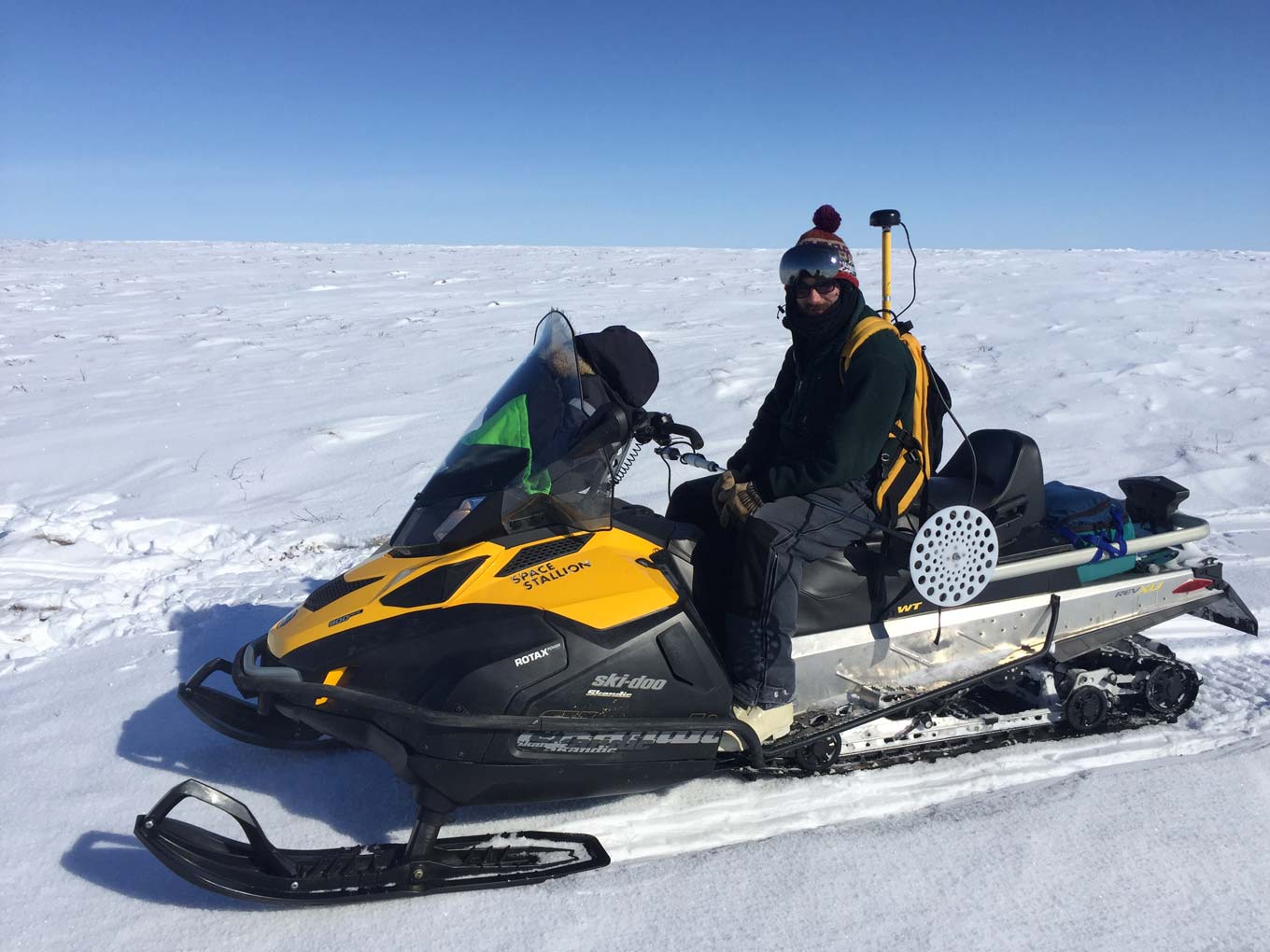
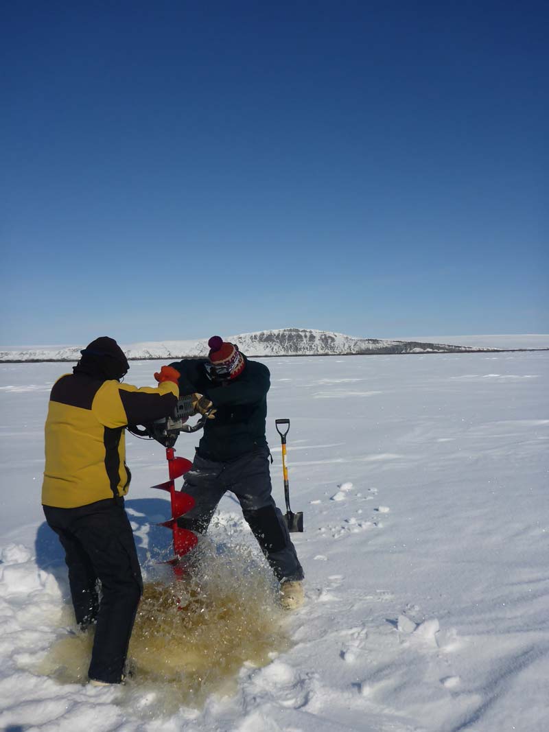
After a rejuvenating dinner and sleep following our ride from Inigok, we arose to another sunny light blue day with dark blue shadows along glowing river bluffs. Andy made pancakes and bacon, we fueled up machines, and took off down the main channel and secondary braides looking for lakes.
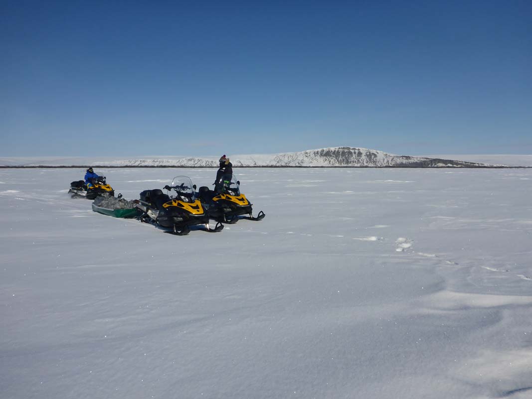
This valley is so beautiful and loaded with wildlife like caribou, moose, hares, wolves, wolverine and most likely quite a few denned up grizzlies. Snow was thinner than usual and finding a path up to the floodplain was relatively easy this time. Sometimes it seems we spend half the day trying to find a way up to these low willow / alder chocked surfaces and higher to river bluffs about 400’ above the river surface. This will be the 6th year in a row we’ve taken these measurements around Umiat in a set of six lakes. We’ve done the same thing at six other areas of the North Slope over this period plus recently adopted Barrow the last two years (Team B did this during the CALON project). We only have one node (study area) to go, Toolik.
We’ll head for Toolik tomorrow traveling 100 mi to the SSE. Crossing the Colville and many of its tributaries, slopes, and ridgelines. If the weather holds we’ll start seeing the Brooks Range grow bigger and bigger as we navigate our way back to civilization...to probe snow, lakes, and permafrost another spring.